

Kuranda to Cairns tunnel proposals
These are proposed tunnel options as alternative to Kuranda Range, from Kennedy Highway to coastal plains in the vicinity of Cairns city.
An upgrade to the Kuranda Range Road is overdue. This road is unsuitable for heavy transport and now has a 60km/hr limit on its entire length due to recognised unsafe conditions.
This road was constructed in 1939 and was built for vehicles in that era. The radial curves in the bends are too sharp for heavy traffic. The rate of accidents and traffic incidents is very high due to steep grades and frequent wet conditions.
Kuranda Range is the main access away from the coastal city of Cairns during emergency events such as cyclones. This road became impossibly congested leading up to cyclone Yasi as residents sought the safety of the inland.
The road passes through the Wet Tropics World Heritage Area and is steep terrain. World Heritage status is a serious inhibitor to any potential upgrades to the range. It leaves commuters using dangerous roads with no regard for the ongoing problem of population growth, and highlights the urgent need for a viable long term alternative.
Any current or future subdivision or development planning on the coastal plain in the vicinity of Cairns city must urgently take into account the inevitable need for alternative access corridors from the hinterland to the coast.
Three possible options are offered, outlining the advantages and disadvantages of each.
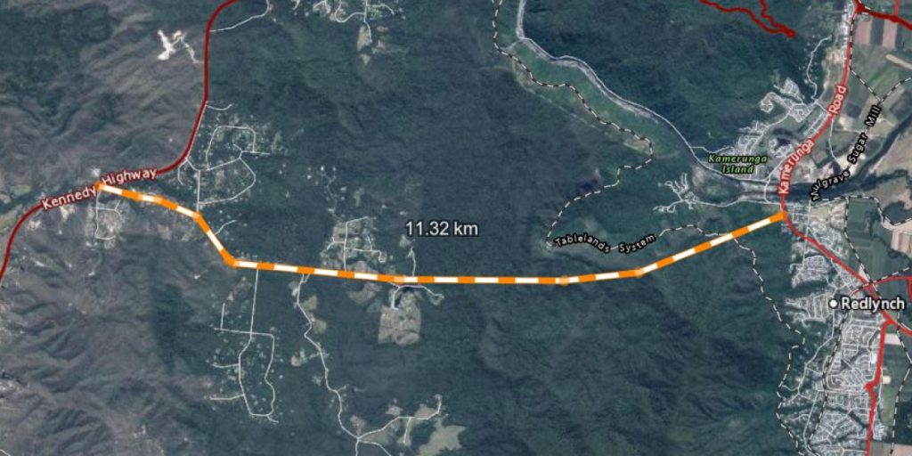
1. Speewah to Kamerunga tunnel
6,000 metres long at 3.9 degrees (6.82%)
Advantages
- 6km tunnel (11km new road)
- Does not affect Wet Tropics World Heritage Area (WTWHA)
- Will not disturb Aboriginal cultural sites
- Does not cross Barron River
- Most construction remains within existing road gazette
- Suitable for water transfer to Cairns City
- Shortest option
Disadvantages
- May be too steep for heavy vehicles
- Some land resumption required
- Heavy vehicles will have to negotiate City (suburb) traffic
Details
The road will start at Stoney Creek-Cairns Western Arterial Road intersection (Lot 174 AP17383 (USL)) and end on Stoney Creek Road (Speewah)
The grade of this tunnel is calculated at 3.9 degrees (6.82%) which will allow a car to drive through this relatively short tunnel in top gear.
Stoney Creek Road (Speewah) is gazetted at 40 metres wide and can be constructed to highway conditions 5 km back to the Kennedy Highway.
THE NEXT TWO OPTIONS ARE IN ANTICIPATION OF COMPLYING WITH TRANSPORT AND MAIN ROADS GRADIENTS FOR TUNNELS.
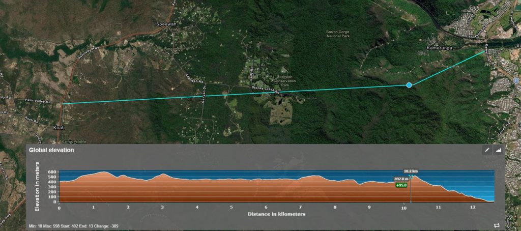
2. Palm Valley Road to Kamerunga tunnel
12,300 metres at 1.85 degrees (3.2%)
Advantages
- 12.3 Km tunnel at 1.85 degrees (3.2%)
- Does not affect WTWHA
- Will not disturb Aboriginal cultural sites
- Don’t have to cross Barron River
- Land resumption minimal
- Suitable for heavy traffic
- Suitable for water transfer to Cairns City
Disadvantages
- Tunnel length
- Heavy vehicles will have to negotiate City (suburb) traffic
Details
The road will start at Stoney Creek-Cairns Western Arterial Road intersection (Lot 174 AP17383 (USL)) and end at Palm Valley Road on the Kennedy Highway.
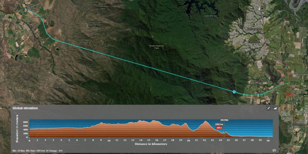
3. Kay Road to Maitland Road tunnel
18800 metres at 1.17 degrees (2%)
Advantages
- Tunnel 18.8 Km at 1.17degrees (2%)
- Does not affect WTWHA
- Offers the most workable heavy vehicle bypass to Cairns City, exiting onto Bruce Highway (Southern access) near Yarrabah turnoff
- Minimal disturbance of Aboriginal cultural sites
- Minimal disturbance of ecosystems and wildlife (Tropical Bettong)
- Don’t have to cross Barron River
- Land resumption minimal
- Suitable for heavy traffic
- Avoids Cairns City traffic (especially heavy transport heading South
- Suitable for water transfer to Cairns City, and close to existing Behana Creek water pipe
Disadvantages
- Longest tunnel
- Some freehold lands will require resumption
Details
The road will start at Kay Road (Kennedy Highway) and exit onto Maitland Road between Edmonton and Gordonvale (Bruce Highway).